
Twinwoods Airfield: the wartime history of this hillside
The lane that climbs west out of Clapham runs, after half a mile of fields, onto a plateau that was a working military airfield within living memory. This page sets out what is documented about it, what is contested, and what a visitor can still see.
An accidental airfield
Twinwood Farm was requisitioned early in the Second World War for the reason most Bedfordshire farmland was requisitioned: it was flat enough, high enough to drain well, and close to the middle of England. The county's clay plateau proved to be almost ideal for airfield construction, and by 1943 Bedfordshire and its neighbours carried one of the densest concentrations of military aviation anywhere in the world.
Twinwoods was a satellite station rather than a front-line base. It served principally as a night-fighter station, and the aircraft most associated with it are the twin-engined wooden Mosquitos and the Beaufighters that preceded them — machines built for the specific, exhausting work of intercepting raiders in the dark using early airborne radar. Night-fighter flying was among the most technically demanding roles of the air war and among the least visible; crews worked alone, at night, in weather, and their successes were counted in single aircraft rather than in headlines.
A much larger station lay two miles away at Thurleigh, which became the base of an American heavy-bomber group. The contrast mattered locally. Thurleigh brought several thousand American servicemen into a rural district that had, until then, measured its population in hundreds. Twinwoods was the quieter neighbour.
The buildings that survive
Most wartime airfields were handed back to agriculture within a decade and are now legible only as odd straight hedges and unusually wide farm tracks. Twinwoods is different, and that is what makes it worth a visit.
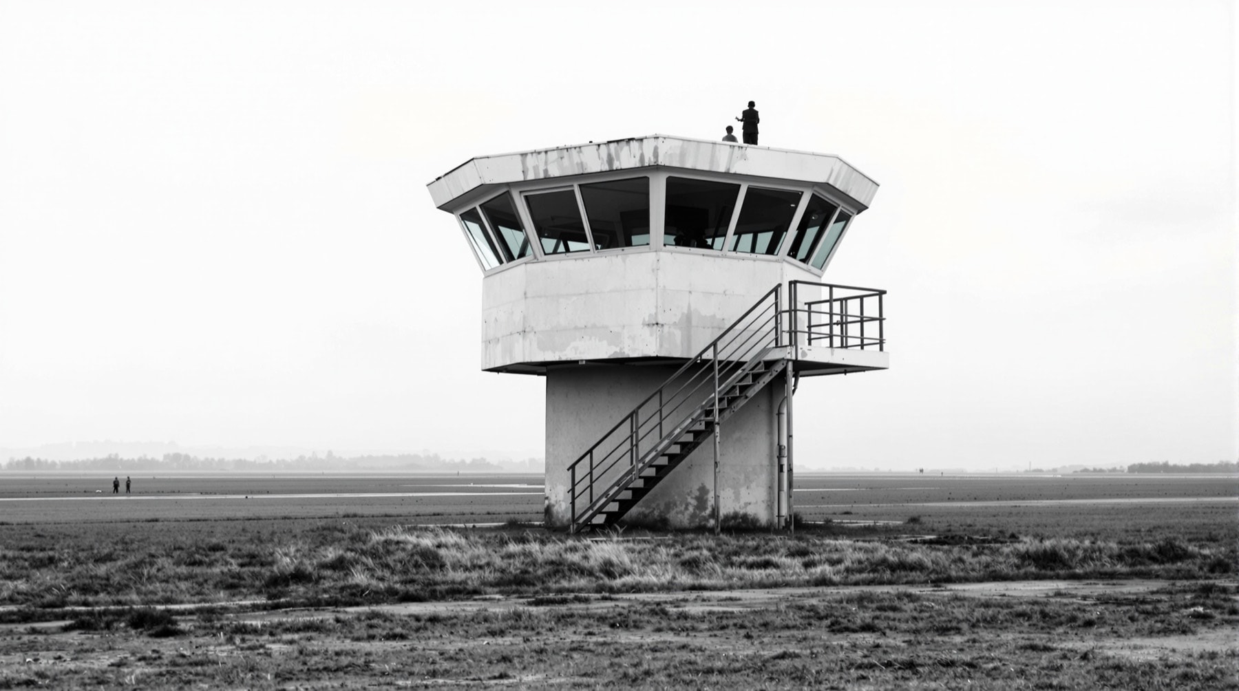
- The control tower. The watch office — the two-storey building from which flying was directed — still stands and has been restored by volunteers. It is the defining structure of the site and now houses a museum of the airfield's history.
- A mushroom pillbox. A low, round, concrete defensive position with a mushroom-shaped overhanging roof, designed to give a machine gun a wide arc across the airfield. Relatively few survive nationally.
- Air raid shelters and blast walls. Half-buried brick and concrete structures scattered along the perimeter, easy to walk past without noticing.
- A hangar and administrative buildings. Including, by long-standing local account, the room used for band practice.
- Accommodation huts. A number of the wartime huts on the slope below the airfield were used as barracks for aircrew and ground staff, and in the later stages of the war to house prisoners of war. Several survive in agricultural use.
Several structures of this type across the country carry statutory protection; the national register maintained by Historic England is the authoritative place to check the status of any individual building.
Reading the surviving evidence
The airfield rewards slow looking because its functions were distributed across a wide working landscape. The control tower is the obvious anchor, but the smaller shelters, blast walls and altered tracks explain the scale more quietly. Look for straight edges, changes of surface and buildings that face open ground rather than the lane. Taken together they make more sense than any one remnant viewed as an isolated curiosity.
There is also a useful hierarchy of evidence. A standing wall or surviving building can be observed directly; its wartime purpose needs a plan, a dated photograph or a contemporary record. Local memory may suggest where to look, but it should not be made to carry more certainty than it can. That distinction matters on reused land, where later farming and events have altered the setting without erasing its earlier pattern.
15 December 1944
The reason Twinwoods is known outside Bedfordshire is a single flight.
Glenn Miller, the American trombonist and bandleader whose orchestra had been the most commercially successful in the world before the war, had enlisted and was leading a large service band in England. On the morning of 15 December 1944 he boarded a small single-engined aircraft at Twinwoods, bound for liberated Paris ahead of his band, in poor winter weather. The aircraft, its pilot and its passengers were never seen again. No wreckage was ever conclusively identified.
What is documented is thin: the departure, the weather, the failure to arrive. What has grown around it is enormous. Explanations offered over eighty years have ranged from the mundane and most likely — carburettor icing and a ditching in a cold sea, in an aircraft type with a known vulnerability in those conditions — to the elaborate. Some accounts are supported by contemporary records; many are not.
This site takes no position beyond the documented facts. Readers who want to go further should start with primary material rather than retellings: the collections and photographic archives of the Imperial War Museums, and the station and squadron histories held by the Royal Air Force Museum, are the reliable foundations. The distinction between a wartime record and a good story is worth holding on to at this particular site, where the two have been intertwined for decades.
What the site is now
The airfield land is partly returned to farming and partly given over to the preserved buildings and an events arena. Large gatherings are held on the field in the summer, drawing crowds who come for the period music and the aviation history in roughly equal measure. On those weekends the surrounding lanes are busy and accommodation across the whole borough books out well in advance; for the rest of the year the plateau is a quiet, windy, open place with long views.
Opening arrangements for the museum vary by season and are not reproduced here, because published hours go stale and a wrong opening time wastes somebody's day. Check directly before travelling.
Reading the landscape on foot
The most rewarding way to understand the airfield is to walk to it rather than drive. Public footpaths climb from the village and cross the plateau, and from the top the logic of the place becomes obvious: the flatness, the drainage, the sightlines down the valley. Route information is on the walking page, and the settlements the airfield was dropped among are described in the surrounding villages.