
About the area: the villages north of Bedford
The country north and west of Bedford is not dramatic. It has no hills worth the name, no coast, no famous view. What it has is depth: a landscape farmed continuously for something like a thousand years, with the evidence still legible in the shape of the villages, the position of the churches, and the way the lanes bend around field boundaries that predate them.
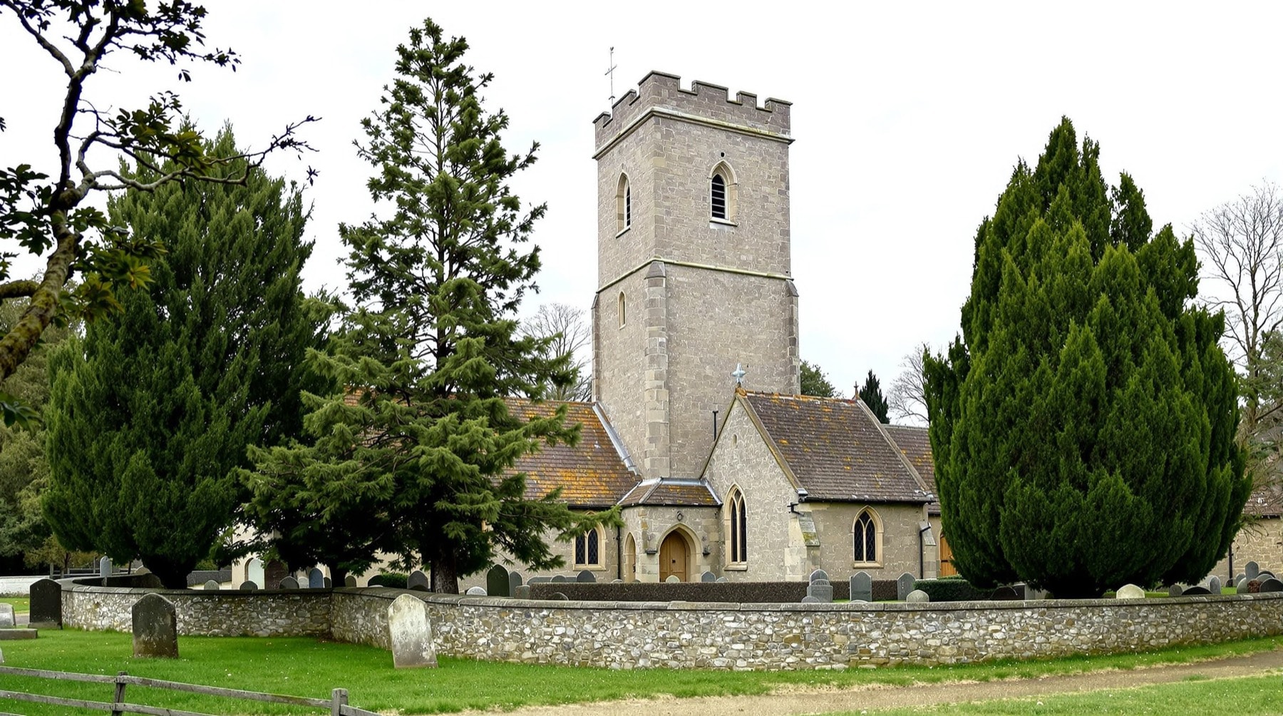
Clapham
Clapham lies in the valley bottom immediately north of Bedford, strung along a single main street with the ground rising sharply behind it. Its parish church carries a tall, plain, square stone tower of a type that predates the Norman Conquest — a genuinely Saxon structure, and one of the more significant early-medieval survivals in the county. It is worth ten minutes of anybody's time. The proportions are wrong to modern eyes in an instructive way: narrow, tall, defensive-looking, built for a world in which a church tower doubled as a refuge.
The village itself is a mixture of old stone-and-thatch cottages, Victorian brick and twentieth-century estate building, which is the ordinary condition of English villages within commuting distance of a town. There is a functioning village centre — the practical detail is on the shopping page — and, immediately west, the ancient woodland of Clapham Park Wood.
Oakley
A mile or so up the road, Oakley sits above a loop of the Great Ouse. Its documented history runs back at least to the twelfth century and probably further; the river crossing here has mattered for as long as there has been anybody to cross it. The village retains a tight historic core around its church and a long bridge over the river meadows that floods, spectacularly and predictably, most winters.
Milton Ernest, Felmersham, Harrold and Thurleigh
North and west, the villages come at intervals of a mile or two, each with its own church and its own character.
- Milton Ernest sits on the A6 north of Clapham, with a watermill site on the Ouse and a nineteenth-century hall that was requisitioned for military use during the war — one of many local buildings drawn into the wartime story described on the airfield page.
- Felmersham has one of the finest medieval parish churches in Bedfordshire, an unusually complete thirteenth-century building whose west front is the sort of thing people drive across counties to photograph. The river bridge below it is a good spot to sit.
- Harrold, further up the valley, has a village green, a lock-up, a market house and an adjoining country park on former gravel workings — a rare example of industrial extraction turned convincingly into public landscape.
- Thurleigh, east of the airfield, is a small village that spent the middle of the twentieth century next door to a very large American bomber station and has been quiet ever since.
How the villages meet the landscape
The gaps between the settlements matter as much as their historic cores. Flood meadow, arable field and small woodland keep one village visually distinct from the next, even where the road journey is brief. That spacing also explains why the river bridges feel like thresholds: the view opens, the ground flattens and the next cluster of roofs only gradually comes into sight.
Approaching on foot makes those changes easier to read. Church towers appear before most houses, older lanes bend rather than run directly, and the sound of the A6 can drop away within a field or two. On a short village-to-village walk, notice where stone gives way to brick, where pasture occupies the wetter ground and where newer building stops at an older boundary. Those modest transitions are the character of north Bedfordshire; there is no single viewpoint that does the work for you.
The statutory record of which buildings in each of these villages carry protection is held nationally by Historic England, whose list is searchable by parish and is the correct source to consult before assuming anything about a particular structure.
The Great Ouse
The river is the organising fact of the whole district. It enters the borough from the west, loops through the villages, runs along Bedford's embankment past the rowing clubs, and leaves eastwards towards the Fens. It is slow, wide, willow-lined and prone to spreading across its meadows in winter, which is precisely why those meadows were never built on and are now the district's best public green space.
Practically, the Ouse gives the area three things: the flood meadows that keep the villages separate, a long and largely walkable riverside corridor, and a genuine water-sports tradition covered on the sport and recreation page.
Pubs and village life
Most of these villages retain at least one pub, and several retain good ones — the sort that do proper food, keep decent beer and fill up on a Sunday. Deliberately, none is named here. Village pubs change hands, change character and occasionally close, and a guide that hands out specific recommendations is usually a guide that is a few years out of date. Walk in, look at whether locals are eating, and decide. The same applies to the shops and services described elsewhere on this site.
Getting between them
The villages are connected by a dense network of lanes and by an even denser network of public footpaths, many of which follow older routes than the roads do. Walking between two villages and back is one of the more satisfying ways to spend a morning here; see walking between the villages. For arrival by road, the orientation page sets out the main approaches. Information on local services, conservation areas and rights of way is published by Bedford Borough Council.